

Animali, Zoologia
Antilopi, Gazzelle
Balene, delfini, foche
Cani, Canidi
Cavalli
Cervi, Daini, Alci
Coccodrilli
Conchiglie
Conigli, Lepri
Elefanti
Farfalle
Fossili
Galline, Galli, Tacchini
Gatti
Insetti
Lemuri
Leoni, Tigri, Grandi Felini
Lucertole
Maiali, Cinghiali
Mucche, Bovini
Orsi
Pecore, Capre
Pesci - Ittiologia
Piccioni, Colombi
Pipistrelli
Ragni
Rane, Rospi
Rettili
Scimmie
Serpenti
Tartarughe
Uccelli
Uova di Uccelli
Altri animali
Arti Decorative
Alfabeti Capilettera Calligrafia
Araldica, Bandiere
Argenteria
Costumi Tradizionali, Antropologia
Decorazioni Fregi
Decorazioni in stile arabo
Decorazioni in stile cinese
Decorazioni in stile giapponese
Decorazioni per tessuti
Gioielli Oreficeria Orologi
Iconologia
Mobili Arredamento Accessori
Piastrelle per Pavimenti
Porcellane di Sevres
Soggetti letterari
Soggetti umoristici
Statue Sculture
Vasi Anfore Suppellettili
Altri soggetti decorativi
Botanica, Fiori, Frutta
ALBERI
ERBARI varie serie
ERBARIO Duhamel ed. 1755
ERBARIO John Hill ed. 1756
ERBARIO Mattioli ed. 1568
ERBARIO Mattioli ed. 1580
ERBARIO Mattioli ed. 1585
ERBARIO Mattioli ed. 1590
ERBARIO Mattioli ed. 1604
ERBARIO Mattioli ed. 1605
ERBARIO Mattioli ed. 1645
FELCI
FIORI varie serie
FIORI serie Alpine Plants
FIORI serie Botanica Coutiere
FIORI serie Botanica Pratt
FIORI serie Favourite Flowers
FIORI serie Fiori della Bibbia
FIORI serie Flore Alpes Schroter
FIORI serie Grandville
FIORI serie Grower Guide
FIORI serie La Plante Fraipont
FIORI serie liberty Rivier
FIORI serie Louis Van Houtte
FIORI serie Onze Flora
FIORI serie Orchidee Godfery
FIORI serie Orchidee Miner
FIORI serie Orchidee Schulze
FIORI serie Pflanzen-Atlas
FIORI serie Piante Utili Ahles
FIORI serie Plantes jardins Bois
FIORI serie Revue Horticule
FIORI serie Scuola Prof. Cappi
FIORI serie The Garden
FIORI serie Wild Flowers Hulme
FOGLIE
FRUTTA
FUNGHI
NATURA MORTA
Carte Geografiche
Europa
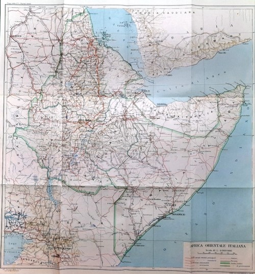
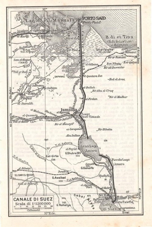
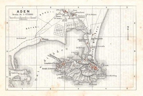
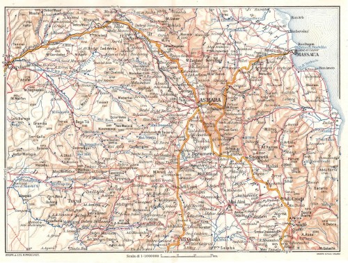
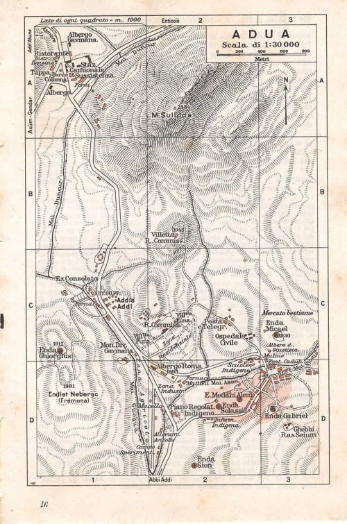
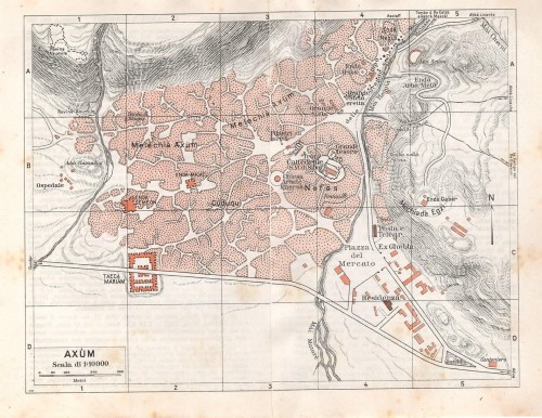
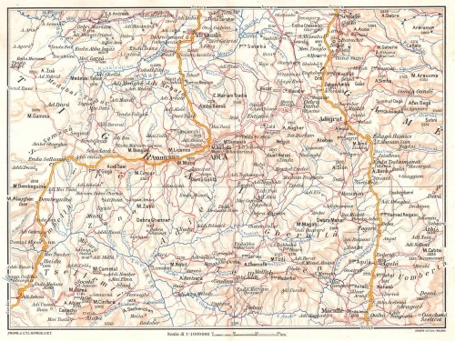
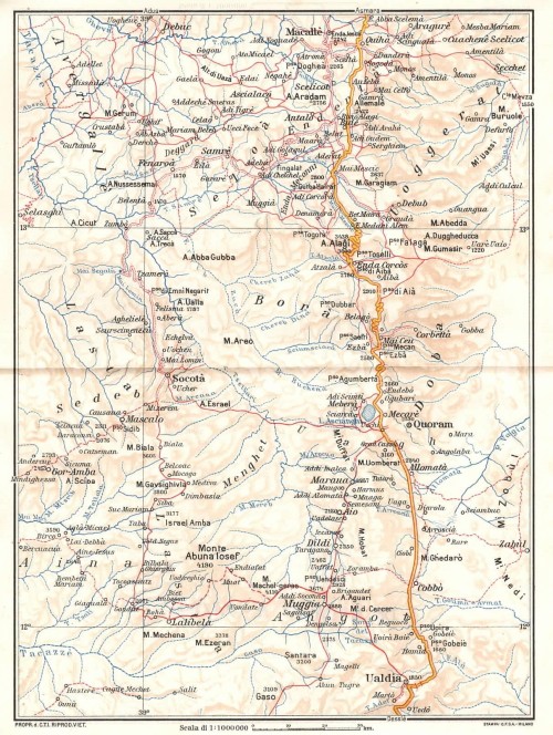
Africa
America
Oceania
Poli
Mappamondi
Carte del cielo, costellazioni, carte tematiche
Europa intera
Albania
Andorra
Armenia
Austria
Belgio
Bielorussia
Bosnia ed Erzegovina
Bulgaria
Rep. Ceca
Cipro
Croazia
Danimarca
Estonia
Finlandia
Francia
Georgia
Germania
Gran Bretagna
Grecia
Irlanda
Islanda
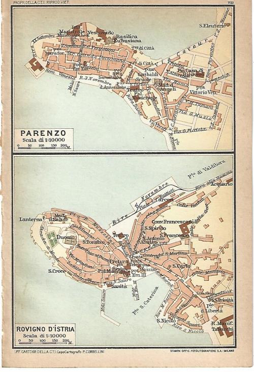
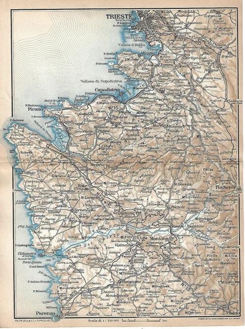
Italia
Lettonia
Liechtenstein
Lituania
Lussemburgo
Macedonia
Malta
Moldavia
Monaco Principato
Montenegro
Norvegia
Paesi Bassi
Polonia
Portogallo
Romania
Russia
Serbia
Slovacchia
Slovenia
Spagna
Svezia
Svizzera
Ucraina
Ungheria
AsiaAlbania
Andorra
Armenia
Austria
Belgio
Bielorussia
Bosnia ed Erzegovina
Bulgaria
Rep. Ceca
Cipro
Croazia
Danimarca
Estonia
Finlandia
Francia
Georgia
Germania
Gran Bretagna
Grecia
Irlanda
Islanda
Italia
Lettonia
Liechtenstein
Lituania
Lussemburgo
Macedonia
Malta
Moldavia
Monaco Principato
Montenegro
Norvegia
Paesi Bassi
Polonia
Portogallo
Romania
Russia
Serbia
Slovacchia
Slovenia
Spagna
Svezia
Svizzera
Ucraina
Ungheria
Africa
America
Oceania
Poli
Mappamondi
Carte del cielo, costellazioni, carte tematiche
Vedute italiane
Val d Aosta e Piemonte
Liguria
Lombardia
Veneto
Friuli - Venezia Giulia
Emilia-Romagna
Toscana
Marche
Umbria
Lazio
Abruzzo
Molise
Campania
Puglia
Basilicata
Calabria
Sicilia
Sardegna
Liguria
Lombardia
Bergamo
Brescia
Brianza
Como
Cremona
Lago di Como
Lago di Garda
Lago Maggiore
Lecco
Lodi
Mantova
Milano cittÃ
Milano provincia
Monza
Pavia
Valchiavenna
Valtellina
Varese
Trentino - Alto AdigeBrescia
Brianza
Como
Cremona
Lago di Como
Lago di Garda
Lago Maggiore
Lecco
Lodi
Mantova
Milano cittÃ
Milano provincia
Monza
Pavia
Valchiavenna
Valtellina
Varese
Veneto
Friuli - Venezia Giulia
Emilia-Romagna
Toscana
Marche
Umbria
Lazio
Abruzzo
Molise
Campania
Puglia
Basilicata
Calabria
Sicilia
Sardegna
Vedute straniere
Vedute Straniere - Europa
Vedute Straniere - Africa
Vedute Straniere - America
Vedute Straniere - Oceania
Vedute Straniere - Poli
Albania
Francia
Andorra
Armenia
Austria
Belgio
Bielorussia
Bosnia ed Erzegovina
Bulgaria
Rep. Ceca
Cipro
Croazia
Danimarca
Estonia
Finlandia
Francia
Georgia
Germania
Gibilterra
Gran Bretagna
Grecia
Irlanda
Islanda
Lettonia
Liechtenstein
Lituania
Lussemburgo
Macedonia
Malta
Moldavia
Monaco Principato
Montenegro
Norvegia
Paesi Bassi
Polonia
Portogallo
Romania
Russia
Serbia
Slovacchia
Slovenia
Spagna
Svezia
Svizzera
Ucraina
Ungheria
Vedute Straniere - AsiaFrancia
Andorra
Armenia
Austria
Belgio
Bielorussia
Bosnia ed Erzegovina
Bulgaria
Rep. Ceca
Cipro
Croazia
Danimarca
Estonia
Finlandia
Francia
Georgia
Germania
Gibilterra
Gran Bretagna
Grecia
Irlanda
Islanda
Lettonia
Liechtenstein
Lituania
Lussemburgo
Macedonia
Malta
Moldavia
Monaco Principato
Montenegro
Norvegia
Paesi Bassi
Polonia
Portogallo
Romania
Russia
Serbia
Slovacchia
Slovenia
Spagna
Svezia
Svizzera
Ucraina
Ungheria
Vedute Straniere - Africa
Vedute Straniere - America
Vedute Straniere - Oceania
Vedute Straniere - Poli


 |
|
 |
|
 |
|
 |
|
 |
|
 |
|
 |
|
 |
|
 |
|
 |
|
Prec. Succ.
Prima pagina Ultima pagina